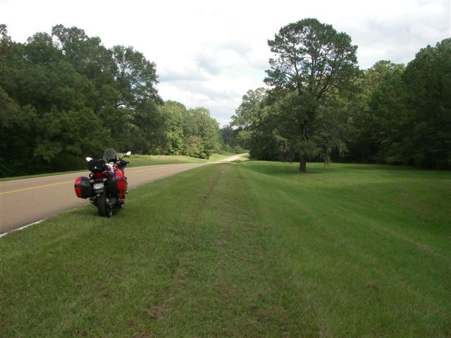
• Ciao Guest - You’ve landed at the ultimate Guzzi site. NEW FORUM REGISTRATIONS REQUIRE EMAIL ACTIVATION - CHECK YOUR SPAM FOLDER - Use the CONTACT above if you need help. New to the forum? For all new members, we require ONE post in the Introductions section at the bottom, in order to post in most of the other sections. ALWAYS TRY A SEARCH BEFORE STARTING A NEW TOPIC - Most questions you may have, have likely been already answered. DON'T BE A DRIVE-BY POSTER: As a common courtesy, check back in and reply within 24 hours, or your post will be deleted. Note there's decades of heavily experienced Guzzi professionals on this site, all whom happily give endless amounts of their VALUABLE time for free; BE COURTEOUS AND RESPECTFUL!
  • There is ZERO tolerance on personal attacks and ANY HYPERLINKS to PRODUCT(S) or other competing website(s), including personal pages, social media or other Forums. This ALSO INCLUDES ECU DIAGnostic software, questions and mapping. We work very hard to offer commercially supported products and to keep info relevant here. First offense is a note, second is a warning, third time will get you banned from the site. We don't have the time to chase repeat (and ignorant) offenders. This is NOT a social media platform; It's an ad-free, privately funded website, in small help with user donations. Be sure to see the GTM STORE link above; ALL product purchases help support the site, or you can upgrade your Forum profile or DONATE via the link above.
  • Be sure to see the GTM STORE link also above for our 700+ product inventory, including OEM parts and many of our 100% Made-in-SoCal-USA GTM products and engine kits. In SoCal? Click the SERVICE tab above for the best in service, tires, tuning and installation of our products or custom work, and don't miss our GT MotoCycles® (not) art on the BUILDS tab above. WE'RE HERE ONLINE ONLY - NO PHONE CALLS MADE OR RECEIVED - DO NOT EMAIL AND ASK QUESTIONS OR ASK TO CALL YOU.
  • Like the new V100, GuzziTech is full throttle into the future! We're now running on an all-new server and we've updated our Forum software. The visual differences are obvious, but hopefully you'll notice the super-fast speed. If you notice any glitches or have any issues, please post on the Site Support section at the bottom. If you haven't yet, please upgrade your account which is covered in the Site Support section or via the DONATE tab above, which gives you full site access including the DOWNLOADS section. We really appreciate every $ and your support to keep this site ad-free. Create an account, sign in, upgrade your account, and enjoy. See you on the road in 2024.

guess this road......

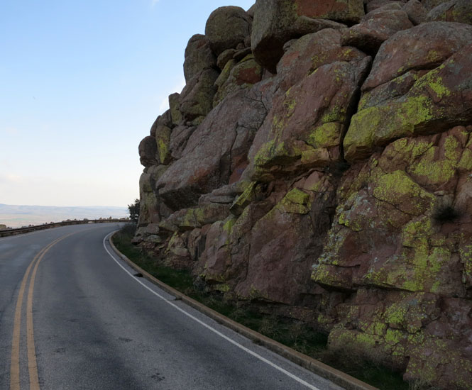
While we wait for Bill to post more roads from his eastern side, I'll toss this one up. You don't want to miss this turn; it's a long way down. But, then, you don't want to go off the inside, either. General Sheridan shot an elk nearby, but that might not be much help to you. This is one of those roads that if it weren't for the WPA, would not ever have been built--it makes no sense.

photo007.JPG
 
Daniel, thanks to Google these days, I see it's in the Wichita Mtns, so is it 49?
 
GT-Rx said:
Daniel, thanks to Google these days, I see it's in the Wichita Mtns, so is it 49?

Close enough. This is the spur road (off 49) to the top of Mt Scott. Oklahoma. Yes; Oklahoma. So what did you Google to get this (correct) answer?
 
Daniel Kalal said:
Close enough. This is the spur road (off 49) to the top of Mt Scott. Oklahoma. Yes; Oklahoma. So what did you Google to get this (correct) answer?
Interesting, thanks... I searched "General Sheridan shot an elk" - third hit down.
 
Well, it's lunch time, so I can, in conscience, "play" a bit.

And,since Our Dear Leader dispatched Daniel Kalal's road as quickly as Gen. Sheridan did that elk, perhaps it's time for another try at the "Name That Road Puzzler."

Before I do, tho, I should thank Daniel, as I had not known until I (as Todd) did a web search, how Gen. Sheridan had been such an advocate of conservation and the national-parks system. As a resident of "the Real Northern Virginia," I tend to think of Sheridan mostly as a frequent "visitor" to area back in '64. ;)

Sheridan also visited Rock Island Arsenal -- where my office is -- in 1883. Suspect he even came into this building, as it would have been among the newest of the post-Civil War construction.


FirstArmyHQsintheAM.jpg


Anyway, here is a photo I took last year.


2012-09-16_08-45-11_960.jpg


Inasmuch as I found a photo taken from the same spot on the website of a national print and web-based magazine ...


SansGriso.jpg


... and also see that the road is listed in at least one "best roads" for the state it romps in, I think it fair to include as one that is (or should be) known to enough to motorcyclists to justify tossing it out here.

Hardly the Cherohala Skyway or Ortega Highway, it is, I assure you, a delight in the morning with breakfast in your belly and the sun on your back.

If no close-enough guesses or spot-on "I know it," I'll provide another clue or two.

Bill
 
Bill Hagan said:
Anyway, here is a photo I took last year.

I certainly like your shot better than the "web site" shot. I'm going to need a hint. Did any famous Rebel general kill an Elk nearby?
 
Daniel Kalal said:
Bill Hagan said:
Anyway, here is a photo I took last year.

I certainly like your shot better than the "web site" shot. I'm going to need a hint. Did any famous Rebel general kill an Elk nearby?

Don't think any rebel generals made it to the state in question, at least during the Civil War, tho Morgan's great raid was relatively close.

There is, however, a confederate cemetery on Rock Island Arsenal.

RIA-Confederate-Cemetery


Perhaps more helpful, albeit not easy, clues might be to think about geological era, plateaus, and juneau.

Best,

Bill
 
Daniel Kalal said:
Wisconsin Dells?

Close enough. Indeed, VERY close.

I would have responded sooner, but thought -- incorrectly -- that I had GPS data for that pic. So ... I've spent an embarrassing (tho quite entertaining) length of time using google maps and street view to "refind" it.

It's here: http://goo.gl/maps/Pe1To

As you may see, just a bit west of Wisconsin Dells, on County Road G -- IMO, there is not a bad "alphabet road" in SW Wisconsin -- between Mauston and Wonewoc. This is part of the "Driftless Area," http://en.wikipedia.org/wiki/Driftless_Area, i.e, where the glaciers didn't visit in the last Ice Age. Left wonderful roads. If one stays alert for Amish buggies and horse and cow pies :woohoo: , it's grand riding. In fact, for all-day frolicking on a Guzzi, I'd put it against about anywhere. Well paved roads, little travelled, courteous people, 93-octane (no ethanol) "recreational" fuel, fried cheese curds, stupendous craft beer, it's a grand part of the world.

Drawbacks? Uhm ... flies. Never seen anything like it. Blech. But, hey, that's why we are ATGATT folks. :p

I heartily recommend the area for a week-long trip. I am excited about retiring back home to Virginia, but will genuinely miss most everything out here except the aforementioned flies ... and winter! :S

Here's parting shot in terrain view of the Driftless region: http://goo.gl/maps/O3kzK

Good job, Daniel.

Bill
 
This photo is from a trip taken thirty years ago on my California Police Guzzi. It's a certainty that Ethan Allan would have known this area (perhaps better than the British), and I'd imagine there was some sort of ferry in operation when he was here. What's the road? Bonus if you can ID the cars...

photo082.JPG
 
Well, it's been two days so, seeing no other guesses, I say this:

http://www.forttiferry.com/

wp06ae581c.png


That is a wonderful part of the world, too. And, not only the roads. Breathtaking scenic beauty, and history at ever crossroads.

And, sublimely confident that I am right -- usually a precursor of gross failure ...

20120611-121110.jpg
--

I'll offer another for your consideration:

NameThatRoad1.jpg


This is such a well-known road for motorcyclists that I will not give any more clues ... yet. :p

BTW, Daniel, anyone else here "playing" this game?

Bill
 
Bill Hagan said:
And, sublimely confident that I am right -- usually a precursor of gross failure ...
Awesomely funny.

I'll offer another for your consideration...
This is such a well-known road for motorcyclists that I will not give any more clues ... yet.
That sure looks like Skyline/Blue Ridge.

BTW, Daniel, anyone else here "playing" this game?
Uh, me(?).
 
Yeah, Todd, but you're management. :p

As for your guess, good, but wrong. Actually, until you said that, I had not realized how much that particular pic does look like certain stretches of the BRP, especially in Virginia below Roanoke.

That's my Norge, tho, and I was returning to Atlanta from MPH in Houston.

Bill
 
Bill Hagan said:
Yeah, Todd, but you're management. :p
As for your guess, good, but wrong. Actually, until you said that, I had not realized how much that particular pic does look like certain stretches of the BRP, especially in Virginia below Roanoke.
That's my Norge, tho, and I was returning to Atlanta from MPH in Houston.
Funny, yes it sure does, and if it's one of the Gulf Coast states, I need a little more of a hint.
 
Back
Top